One destination for all your digital mapping needs
From the coastal state of Lagos to the hilly suburb of Jos down to the ancient city of Kano, STL now offers digital map coverage in over 120 cities across Nigeria and still counting.
The reasons for the popularity of our database lie in the way we build it. Teams of field analysts fan out across Nigeria each day, continually driving and redriving the roads, using proprietary digital data collection tools so that STL's digital map data more closely reflects real world conditions. We can collect up to 10 road attributes on each section of road, and we add thousands of Points of Interest to the database. The result is digital map data like no other in Nigeria.
For accurate digital map data for fleet tracking, routing and scheduling, or geographic analysis and modelling, STL's Digital Maps is your one-stop shop. Whether you're from business or government, we have a product to suit your mapping needs
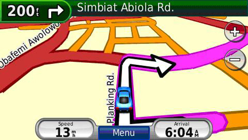
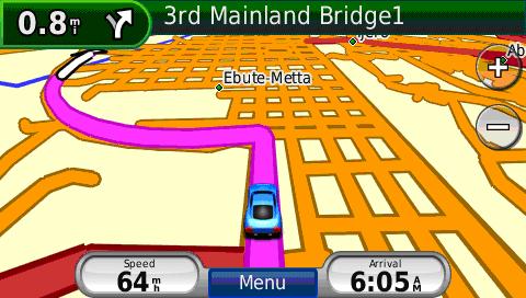
STL’s Street Routable is an intelligent and detailed street centreline database that details the road network across Nigeria in a seamless digital (vector) format. In addition to street names, suburbs and road hierarchies, it also includes speed, traffic direction, one-way, and other routing functionalities. Our Street Routable product is used for vehicle tracking that requires routing capabilities.
Who uses it?
Street Routable is ideal for corporate and government users who require maps and data for logistics, transport planning, vehicle despatch, vehicle tracking, asset management, traffic modelling, Satellite Navigation or market analysis.
How will it help my business?
It can help a business save time and money in a number of ways, for example, by providing the shortest path between delivery points. This further benefits a business by reducing wear and tear on vehicles and increasing the output of delivery services. How much does it cost? This varies by application, number of users and extent of coverage.
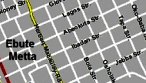
Street Data is a digital (vector) street centreline dataset derived from the same databases as Street Routable. It has the same geometry and accuracy as Street Routable. Street Data has had all navigation attributes removed.
Who uses it?
Street Data is designed for corporate and government users who need map data for display purposes or to enable vehicle tracking, GIS project, market analysis, and branch locator applications.
How will it help my business?
It helps you to save time and money by providing accurate and up-to-date maps for your business needs. For example, it enables you to keep an eye on the location of your assets at any point in time.
How much does it cost?
This varies by application, number of users, and extent of coverage.
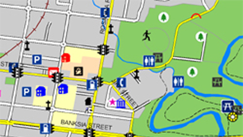
The primary use of points of interest is to allow identification of different facilities or resources within the built and natural environment. The data can be used within a table format, such as a spreadsheet or a database to create gazetteer or list type applications that allow people to search for a particular facility or resource.
Who uses it?
Government could use the Points of Interest in developing the National emergency management solution. Business owners can also benefit from Points of Interest data as it enhances the functionality of mobile digital devices from phones to PDAs and personal navigation devices by allowing users to pinpoint attractions and services, e.g. Hot Chicken at ‘Tastee Fried Chicken’ on Ogunlana Drive -Surulere
How will it help my business?
Imagine having a tool at your fingertips that could direct each and every customer to over 50,000 places, attractions, services, venues, hotels, Banks, ATMs, and much more, right across Nigeria.
How much does it cost?
This varies by application, number of users and extent of coverage.
STL’s Professional services

Each of the analyses above can be provided as either a consultancy service or can be performed in-house using MapInfo Professional software –a professional mapping and business making tool based on the visual power of GIS and map.
GIS Consultancy Services

For those companies that would prefer to out-source either a single GIS project or a long-term strategic venture, STL can help. STL can either carry out project-based consultancy assignments or second staff to a clients' premises to work on-sites. Projects are typically bespoke and tailored to each client's commercial requirements.
In-House Empowerment GIS

STL empowers its customers to perform their own market analyses and modelling if they have the in-house resource and skill to do so. A professional off-the-shelve GIS and mapping software is provided on license as a desktop application. Unlimited training and a team of dedicated technical helpline is also provided.